Need it to appear in the place it belongs?
A building on a screen is a picture. Tied to the plot it will stand on, or to a printed marker, it becomes something people can stand in. GLME, our geolocation and marker framework, shows the right content when someone reaches a spot or points their phone at a marker, and lets you change it all from one system.
The idea Let people walk round the new building before it is built
Where people stand
Use it when the place is the point.
GLME knows where someone is and what they are pointing their phone at. That suits any idea that only makes full sense on the spot.
-
Trails and tours
Interactive city tours and heritage trails. People get information about landmarks, historic sites and local attractions as they walk, with audio guides and AR scenes at each stop. It is a good way to bring visitors to an area.
-
Shops and centres
Personalised offers and product details when someone is near a particular store, and exclusive deals for those who scan a marker. It gives people a reason to come in person.
-
Museums and classrooms
Educational tours where students and visitors meet a marker at each exhibit. Location guides them along a set path, and each marker opens detailed content or an activity about what is in front of them.
Layers of a place
Five layers make one place.
GLME stacks what it knows about a spot, one layer on another. Step through them to see what each adds.
-
Location
GPS, Wi-Fi and mobile signal work together to find where someone is. The framework follows them as they move, so what they see keeps up with where they are.
-
Geofences
Virtual boundaries drawn on the map. A marker or a story wakes up only inside its fence, so an offer can appear when someone walks into the area and scans a code.
-
Markers
Images, QR codes, surface mapping and AR objects give people something to point their phone at. A marker can work anywhere, or only inside a fence.
-
Content
What happens when a place or marker is found: information, sound, animation, an AR scene or a minigame. It is all kept in the GLME CMS, so adding a stop or changing a story is done in one place.
-
Analytics
Live figures show how people use the experience and which locations get the most interaction, so you know what to improve next.
Markers
What people point at.
A marker is the thing a visitor finds, scans or looks at. Which one suits depends on where it will be and what it should do.
| Marker | How it works | Suits |
|---|---|---|
| Location only | No marker at all. The content appears when someone enters an area. | Walks and trails that guide people from one point to the next. |
| Image | The phone recognises a picture, poster or sign. | Printed material and exhibits that need to come alive. |
| QR code | A scan unlocks the content. | Shops, centres and stands where a code can be placed. |
| Surface mapping | The phone maps the space around the person and holds AR content in it. | Placing something at full size on a real spot, such as a plot of land. |
| AR object | A 3D object in the world is itself the point of interest. | Trail stops and exhibits where people can walk round something. |
Walk to the plot, hold up the phone, and the building is standing there.
The same idea works below ground. For one public sector client we built a mobile AR app that gave utility and roadworks teams an X-ray style view of underground infrastructure, so they could see it at the exact place before work began.
On the ground
A journey across Fife.
In the Footsteps of Kings takes people through Fife with augmented reality, following the paths of past kings and queens. Each scene waits at the place it is about.

Trails
Walk it, and the story follows.
For tourism and hospitality, GLME turns a town or a stretch of countryside into something to explore. Visitors get location-based information as they go, and markers at each point of interest add audio guides or AR visuals.
Location guides people along a path. The markers hold the detail at each stop. You decide how many stops there are, in what order and what happens at each, and you can change them later.
The control room
Run it from one system.
Everything a visitor sees is managed in the GLME CMS, and the same system reports back on how people use it.

Content
Add a new location, update some copy or set up a new minigame. Each marker is placed on a map and edited in a form.

Analytics
See which locations get the most interaction and how people move through a trail. The figures shown are an example dashboard.
Made to fit
The framework bends to the idea.
GLME is a framework, not a finished app, so each project starts with the hard parts of location and markers already working. We design custom responses with you. They might show information, start an action or trigger an animation.
It runs in mobile apps and in web applications, so people get the same experience on whichever device they have. And if you want a feature it does not have yet, our team will help you get there.

How we work
From first idea to the first stop on the map.
-
Plan the places with you
We work out with you where each stop is, what should happen there and whether it is triggered by location, a marker or both.
-
Build on the framework
Our designers, 3D artists and developers make the scenes and activities, and you test them in the real places at each stage.
-
Run it from one system
Locations, copy and activities are managed in the GLME CMS, which also shows live figures for how people use each place.
-
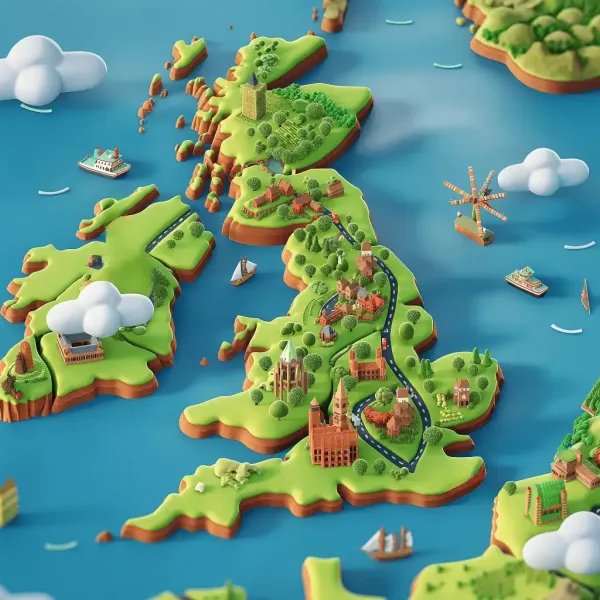 Travel & Tourism
CrossCountry Journeymaker App
We partnered with CrossCountry Trains to create JourneyMaker, a free AR app packed with fun activities for young travellers. From...
Read the story
Travel & Tourism
CrossCountry Journeymaker App
We partnered with CrossCountry Trains to create JourneyMaker, a free AR app packed with fun activities for young travellers. From...
Read the story
-
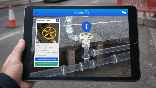 Training & Education
AR Infrastructure Visualisation for Public Sector Field Teams
Harmony created a mobile augmented reality app for an overseas public sector client, giving utility and roadworks teams an “X-ray”...
Read the story
Training & Education
AR Infrastructure Visualisation for Public Sector Field Teams
Harmony created a mobile augmented reality app for an overseas public sector client, giving utility and roadworks teams an “X-ray”...
Read the story
-
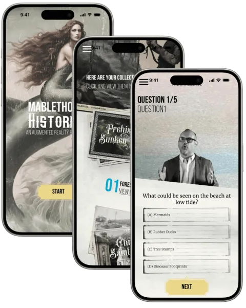 Travel & Tourism
Mablethorpe Histories
Experience Alderley Edge like never before this innovative mobile app. Using advanced geolocation technology, the app enhances you...
Read the story
Travel & Tourism
Mablethorpe Histories
Experience Alderley Edge like never before this innovative mobile app. Using advanced geolocation technology, the app enhances you...
Read the story
Questions
Good to know
-
What is GLME?
GLME stands for geolocation and marker experience. It is a framework Harmony built for location-based apps, with its own content management system and analytics, so each new project starts from something that already works.
-
What counts as a marker?
An image, a printed poster, a QR code, an AR object or the surface of the space around the person. A marker can work on its own or only inside a set area.
-
Can we change the content after launch?
Yes. Locations, copy and minigames are all managed in the GLME CMS, so you can add a new stop or update a story as things change.
-
Does it work in an app or in the browser?
Both. The framework works in mobile apps and in web applications, and we choose with you whichever suits the people using it.
-
Can it do something we have not seen yet?
Probably. We design custom responses to a location or a marker with you, from showing information to starting an action or an animation. Tell us what you want to happen and we will work out how.
Your idea
Talk it through with us
Tell us what you are trying to explain, launch or change. We will work out with you whether this is the right medium for it.
Also in Immersive Experiences (XR)
Other ways to tell it
-
Augmented Reality Development
Some things are easier to judge, buy or learn when they are in the room at the right size. Augmented reality puts them there through the camera of a phone or tablet, so people can walk round them.
-
Virtual Reality Development
Some places cannot be visited yet, are too risky to practise in or are simply too far away. Virtual reality puts people inside them at full size, wherever they happen to be.
-
Location-Based VR Development
Some experiences are better shared. Location-based VR maps a room in your venue to a virtual world, so a group can walk through it at the same time and talk about what they find.
-
WebXR
Plenty of people will not install an app to look at one product. WebXR runs 3D and augmented reality in the browser they already have, so a link, a printed code or a button on your product page is all it takes.
Your turn
What’s your idea?
Tell us the idea you are trying to explain, launch or change, and together we will find the right way to tell it.