We developed an augmented reality mobile app for a government client, helping authorised utility and roadworks teams see underground infrastructure before work began.
Challenge
The client needed a clearer way for field teams to understand what was beneath the ground while working on site.
Traditional maps and asset records were useful, but they could be difficult to interpret in the field, especially when teams needed quick, practical information before excavation, inspection or repair work.
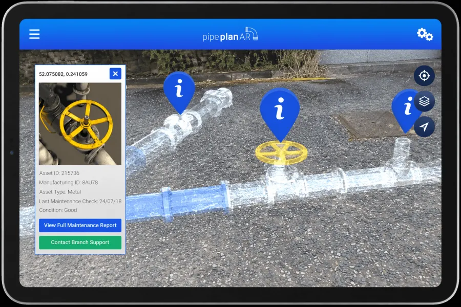
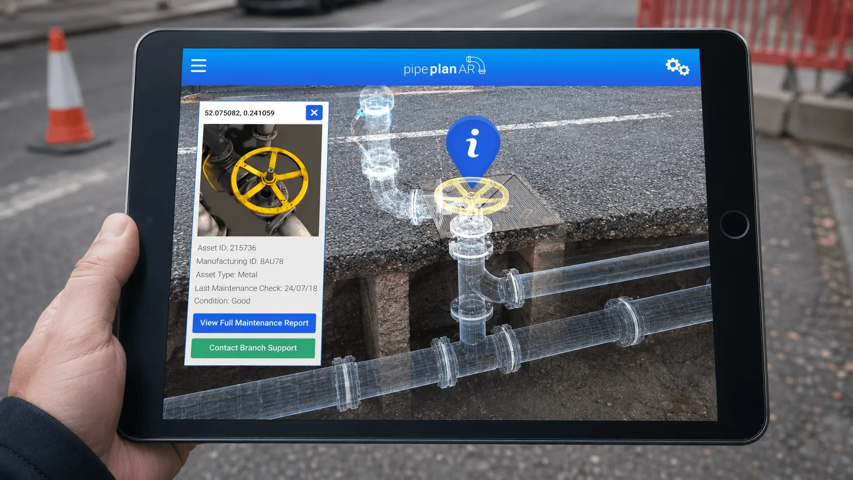
The aim was to give authorised users the ability to scan the ground with a phone and view pipes, cables and service routes in an “X-ray” style mode.
Solution
We designed and developed a mobile AR app that brought together geospatial data, SLAM technology, depth masking and 3D visualisation.
The app used SLAM to understand the user’s movement and surroundings, geolocation to place infrastructure data in the correct real-world position, and depth masking to show buried assets below the surface rather than floating above it.
This gave field teams a simple way to point their device at the ground and see pipes, cables and service routes in context, using clear 3D visuals rather than relying on flat records alone.
Results
The solution helped field teams reduce uncertainty before work began, make better-informed decisions and interpret underground asset data more quickly.
The project showed how AR, geolocation and depth-based visualisation can turn complex technical records into something users can see, understand and act on in the real world.